views
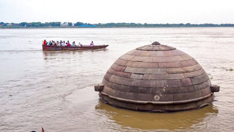
Heavy rains in Uttar Pradesh have caused River Ganga to overflow in Varanasi, leading to severe flooding at the Mahashamshan Ghat. The rising water levels have submerged the steps of the banks, damaged connecting roads, and inundated the cremation platforms at both the Manikarnika and Harishchandra ghats. The escalating situation left the cremation platforms underwater, forcing residents to seek alternative arrangements for performing last rites.
With current conditions, there is a possibility that cremations may need to be conducted in the streets of Harishchandra Ghat if the water levels do not recede soon. Authorities are closely monitoring the situation and preparing contingency plans to address the growing crisis.
Nitesh Yadav, a wood vendor for cremations at Manikarnika Ghat, reported that the water levels of River Ganga have risen significantly over the past 2 to 3 days, causing the cremation platform at Manikarnika Ghat to become submerged. The rising water has exacerbated space issues on the ghat, making it increasingly difficult for families to perform last rites. Yadav warned that if the water level continues to rise, the situation will likely worsen, further complicating cremation efforts.
If the water level continues to rise, cremations at Harishchandra Ghat, which are currently being conducted on the stairs, may need to be relocated to the streets. Kalicharan, a cremation service provider, reported that due to the flooding, people are currently facing delays of up to 1.5 hours for cremation services.
According to the Central Water Commission, the water level of the River Ganga in Varanasi has remained stable since Thursday morning. As of 8 am, the river’s water level is recorded at 63.86 metres, approximately 7 metres below the danger mark of 71.26 metres. The warning point for the river is set at 70.26 metres.


Comments
0 comment